This is a comprehensive long form trip report & pictorial detailing a road trip loop itinerary around SW Colorado and SE Utah that included stops & visits to:
Durango -> Silverton -> Ouray -> Montrose -> Black Canyon of the Gunnison National Park -> Colorado National Monument -> Moab -> Arches National Park -> Canyonlands National Park -> Ouray -> Telluride -> Mesa Verde National Park -> Durango.
A longer visit probably would have included Capital Reef National Park, Monument Valley, and Four Corners but those latter two were closed due to Covid-19.

*Covid-19 disclaimer at bottom of this report.
————————————————————————--------------------------
As I sit here in the Durango airport waiting for my return flight home and journaling the trip, I’m reliving the last week in my mind. If I had to describe the week in one sentence, it would be this: We sure know how to pack a lot into one day.
I don’t know where we find the energy. But this has been typical of our family vacations. Except this time, it was only my daughter and I. Well...we both had some solo time too. We had a family vacation planned in July for all five of us but like for so many people, those plans got cancelled due to Covid-19. Not to be deterred, McIntyre was intent on doing something. And that something was a road trip out to Colorado and Utah to visit some National Parks. Who am I to let her have all the fun alone?
So we hastily made some plans well less than two weeks out from our trip. She already had an itinerary set for certain days and locations to visit, so I just dropped in on part of it to tag along on her adventure. She basically led the way. The tables were turned. I used to do all the planning and the driving. Now I was the passenger along for the ride. Yes, she drove during most of our time together. Talk about giving up control. I thought it would be hard but I was super relaxed and enjoyed being the passenger.
She would drive solo out to Kansas City and stay one night with her friend and former college roommate, then continue on to Colorado Springs and see some of the sights there including Garden of the Gods. She had other plans too, such as hiking Mount Sherman (a 14’er) then driving up to Pikes Peak. Those plans got shuffled when she experienced hail and lightning on the way up Mount Sherman and had to shelter under a large boulder then return to her car. As she retold the story to me later, it was quite apparent she had quite the crazy day.
During all this, I had flown to Durango to do some mountain biking before I met up with her. So this is where the story begins...
Friday July 10th
I flew into the Durango, Colorado airport. As you can imagine, it’s a small airport with only one small terminal...but it’s nice. Easy in, easy out...and only 20 minutes from downtown Durango. However, I also arrived at the same time as a heat wave. The high would be 95 degrees that afternoon.


I had a mountain bike rental waiting for me at 2nd Avenue Sports in downtown Durango CO...a sweet Santa Cruz Tallboy XL. They got me all set up, then I checked into my downtown AirBnB condo...and I was off...I rode up Horse Gulch’s main trail from downtown. Looped the beginner Meadow Loop and Stacy’s Loop for a warm up.
Then I headed up Telegraph Trail, which is a local mountain bike time trail for the local competitive riders. Old early 20th century era telegraph wood poles with old cable were littered up and along this trail.


Cresting the saddle, I dropped into the Sidewinder trail, then rode the South Rim trails for a while into the Sale Barn trail, then descended to the Animas River Trail, which took me back to town. Of course, I had to stop by Ska Brewery for a cold beer, then I hopped in the Animas River to cool off.
I also passed by the town's very cool flow track and BMX race tracks they had laid out nicely for everyone including families. There were families at the BMX Track and the kids were working on their race starts. Total ride distance was just over 24 miles and over 2,250 ft elevation gain.


Saturday July 11th
The next day’s forecast called for 98 degrees. So I was off to higher elevations for the next ride. Molas Pass to Engineer Mountain Trail in the San Juan National Forest. One word: Wow. Most beautiful mountain bike ride I’ve ever done...and the hardest. Sweeping views and unrelenting climbs up to the Engineer Mountain Trail where it also crosses over the famous Colorado Trail (which runs between Denver and Durango).


The trail starts at 10,800 ft elevation, and tops out at 12,100 ft. The total time up and back was 6 hours. 2.5 hours of that were spent taking rest breaks to let my lungs and legs get a reprieve...and enjoying a sandwich by a small glacial lake at the top before heading back down.


I met some fun Durango local riders and Tulsa OK riders along the way. The Tulsa guys were like me...we both live at very low elevations and were enjoying the high altitude challenges. So actual ride time was 3.5 hours, 21 miles, and just over 3,000 elevation gain total.


I don’t use the word “epic” much...it’s truly reserved for only the most special and most challenging of adventures. That ride was epic. It wouldn’t be the only epic time of the week.


I got back into town just before the bike shop closed so I decided to go switch out rental bikes. I wanted to try a different brand & model. 2nd Avenue Sports was awesome. They quickly set me up on a Yeti SB130 XL, a highly touted all mountain/trail bike. I was excited to try it out the next day.
Sunday July 12th
I was planning to do the Hermosa Creek Trail (18 mile mostly downhiller) the next day but the shuttle I had lined up fell through. But I was given another great trail recommendation close to town - in Perins Peak State Wildlife Area - Dry Fork Trail 4 miles up to the Colorado Trail, up the CT for another 5 miles, then back down, then hit Hoeffeins Trail back down (fun downhiller!) to the Dry Fork Trail. A fun lollipop loop that had forgiving gradual climbs...thank goodness for that as my legs and lungs were a bit spent from the day before.


I started off early that morning to beat the heat. I met a young couple at the high point of the Colorado Trail that had hiked the entire CT from Denver and were on their last day hiking down to Durango. It was day 80 on the trail for them. My total ride distance was just under 19 miles and over 2,700 ft elevation gain. That Yeti SB130? I absolutely loved it. Might have to be my next bike.


Monday July 13th
I had met another local rider who gave me another great trail recommendation for my last morning before I left Durango. It was very close to town and again I started off early to beat the heat. It was the Twin Buttes trail area, which takes you up a ridge that overlooks Durango, then sweeps just below a large mesa and then around the Twin Buttes, then a fun downhiller back down.


Again, I was loving the Yeti SB130. Total ride distance was 8.5 miles with just over 1,200 elevation gain...perfect for the final parting shot ride before departing Durango.
My total ride stats for the four outings in less than 70 hours were 73 miles and 9,242 ft elevation gain.


I used the MTB Project app to assist with trail recommendations and maps that kept me from getting lost. I also did more research at these web sites:
I ate at various places downtown but the standouts were Chimayo, Steamworks Brewing Co, Carver Brewing Co, and the Durango Diner for breakfast.
A note about Durango - you can tell this was truly an Old West town. There were remnants of old historical hotels and saloons still standing, many renovated into modern use but still had the old historical feel. It’s also a biking town. Much like on Hatteras Island where every other car has windsurf boards and kiting equipment strapped on top, every other car in Durango had mountain bikes racked up. The Animas River that runs through town is such a key feature.


I have found that the best adventure towns in America all have one common feature - a river that runs through it. There is a very cool whitewater park at Santa Rita Park that has Class 2 & 3 waves for the rafters and kayakers. This would play into our adventures later in the week. It also has some great swimming holes there for humans and dogs alike. Durango is so nice, even the homeless have laptops. I kid you not - I actually saw a homeless guy downtown holding a small laptop close to his face so he could see the movie he was watching.

From Durango, I made the 2.5 hr drive to Montrose to meet McIntyre. Along the way, I drove through Silverton and Ouray along the Million Dollar Highway. I saw two large moose lounging in a basin just outside Silverton. They were too far away to get a good picture but they were gigantic with big ears.


I suppose it’s called the Million Dollar Highway because this area was big on mining as far back as the late 1800s. Silver was the big prize and tiny mining towns sprung up along this route. Their remnants remain. Reclamation projects have been in process for a long time since these mines shut down, to get the environment and area waters back into shape. Except for the cars, Silverton was a true step back in time. Dirt roads and old saloons. I could envision the cowboys strolling through this old town on horseback.
I dropped off the rental car at the Montrose airport and McIntyre picked me up. Reunited at last! We enjoyed a burger and beer at the local Horsefly Brewery as she relayed her crazy day to me. Afterwards, we checked out the Montrose Water Sports Park...their version of a whitewater park, which is along the Uncompahgre River. While smaller than the one in Durango, it was a really nice park with trails, ball fields, playgrounds, skate park, and a couple small river waves.


Tuesday July 14th
McIntyre and I set off early for Black Canyon of the Gunnison National Park. This was a much smaller version of the Grand Canyon except instead of the red rock, it was truly black and grey, with jagged edges, and interesting and artistic erosion lines throughout. We drove the South Rim and enjoyed the various lookouts. It was still grand by any standard...and beautiful.


Then we drove down to the Gunnison River by way of East Portal Road. We considered for one minute doing the hike down to the river and back up but that would have taken all day and we weren’t up for that today. The sign on the East Portal Road entrance that said 16% grade should have been a clue but we finally got wise and put McIntyre’s trusty Ford Escape into manual drive and drove it in 1st gear after we smelled the burning brakes. Yikes!
This wouldn’t be the first test of her car this week...by a long shot. The Gunnison River was really nice. There were several fly fishermen already down there. We probably walked a total of 2 miles at the various viewing lookouts at the park.


We then set off towards Moab, Utah, (3hr 10min), but on the way we stopped to see the Colorado National Monument. McIntyre had already scoped out a hike she wanted to do here...The Devils Kitchen Trail. In the 94 degree heat, we did the short 2 mile hike up and around the red rock. Afterwards, we drove the rest of the twisting road up and through the Colorado National Monument with its sweeping red rock and canyon views, then down to Fruita, then continued onto Moab.


As we crossed the border into Utah, the current heat wave provided a nice toasty 104 degrees outside the car. Ahead of us, we could see some rain and lightning. The clouds looked different than the usual Carolina thunderstorms I’m used to. They weren't giant anvil thunderheads, rather just normal looking rain clouds but were darker. The lightning would happen well outside these clouds in the blue sky.
Pretty crazy. When the rain reached us, the wind really picked up...and the temperature dropped 40 degrees. You read that right. In a matter of minutes, it went from 104 to 64. We exited the rain as we entered Moab and the temperature steadily climbed back up.


McIntyre is fascinated by tiny houses and wanted to stay in one. So that’s what we did. She found a “glamping tiny house” AirBnB at the Funstays Redrock Campground. I wasn’t sure what to expect. When I think of “tiny house”, it doesn’t exactly instill any confidence in comfort. But I was pleasantly surprised. It was very nice and comfortable. We ended the evening with some Mexican food and a beautiful sunset at the campground that looked more like a wildfire.


Wednesday July 15th
It was forecasted to be 105 degrees later in the day, so we got up early and drove into Arches National Park. As we came over a high ridge and into the expanse of the park in front of us, it was what I like to call a “Bam!” moment. Or a Wow moment as most folks would say. Red rock spires, poles, and arches spread out across the landscape in front of us.


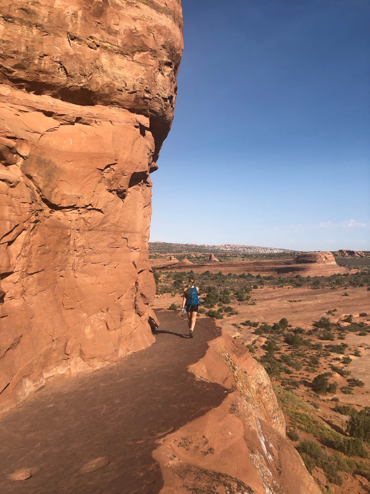
McIntyre had us planned to begin by hiking to the famous Delicate Arch. It was a heavily trafficked trail but everyone was doing a pretty good job of social distancing. On the way up, we saw a mother deer and a small baby deer amongst the small scrub brush. It’s amazing how anything lives in this harsh environment. It was a well marked trail until at one point, we didn’t see any more signs but continued along a well worn path in the rock and following a young woman in front of us who appeared to know where she was going. We still got to Delicate Arch but I wouldn’t recommend going this way.
The final scramble up consisted of navigating a tight ledge which dropped off into a giant rock bowl. A quick Google search later showed that several people have died at this spot by sadly falling into this bowl. We found the right trail back later and realized we simply didn’t look to our left on the way up to see the trail sign pointing to the correct path up. So beware of this if you go.


Delicate Arch was an amazing site to behold. It is truly amazing what millions of years of wind and water can do to an environment, particularly rock. I wonder what it will look like in another million years. Delicate Arch will likely have crumbled by then but new arches will have formed.
We drove on to other parts of the park to see other arches and features. Double Arches was really cool as well. We ended up hiking about 4.5 miles in Arches National Park at these two particular arches and some other lookout view points.


We then drove into Moab for a quick bite at the #1 TripAdvisor rated Moab restaurant, a quesadilla food truck in the middle of downtown aptly named “Quesadilla Mobilla”. It was very good and the bonus was the water misters in the shaded seating area.
McIntyre wanted to see another famous arch, except it wasn’t in Arches or Canyonlands National Park. It’s the Corona Arch, known for being the “country’s biggest rope swing”. Look it up on YouTube. This extreme version of rope swinging was banned in 2014 after someone misjudged their jump and slammed into the arch wall and died. This was a 2.8 mile round trip hike...and by this time it was 104 degrees. We felt every bit of that heat. There were only a couple of shady spots along the way.


But it was worth the effort. Another very large and long arch that looked out into a valley surrounded by red rock canyon walls. McIntyre later joked at the irony of hiking the “Corona” Arch trail during the pandemic, remarking that it was running a fever of 104 degrees.

We then set off for Canyonlands National Park but first stopped for a quick dip in the Colorado River. It was a shallow section of the river so the water wasn’t very cold and refreshing...but it helped cool us off somewhat. We watched a deer enter and swim across the river just downstream of us.
We drove into Canyonlands National Park and the “Islands in the Sky” district which is the most accessible district from Moab. The other districts are more remote back country areas that appear worthy of more exploration but would require a lot more time. We were so tired from the earlier activity in the day’s heat that we skipped the longer hikes and just drove to all the viewpoints just off the main road and briefly got out of the car to look out at the beautiful landscapes.
Canyonlands is bigger than Arches and it showed. There were definitely rock “islands in the sky” and big canyons both close up and way out to the horizon. You could barely see the Green River which cuts a path through the park.


The other big thing that got my attention was White Rim Road, which is a 4WD only accessible road that follows the entire outline of the Islands In The Sky District. I have read about this 100 mile road before. You can mountain or gravel bike it...or drive your 4WD vehicle through it. It’s recommended to allow for at least 2 days to drive it.
I overheard a man at one of the overlooks say he drove a small section of it earlier in the day and he said he couldn’t go more than 5mph in his vehicle...that it was “unrelenting”. The gauntlet was thrown. It’s now added to my bucket list - to drive it or bike it...and camp along the way. Of course, I would do it in the fall or spring.
We ended the day super tired. That heat took a lot out of us. The wood fired pizza at Antica Forma was superb. We slept good that night in our tiny house.
Thursday July 16th
From desert red rock canyons back to high alpine rocky peaks, we made the 2 hour 45 minute drive into Ouray, which bills itself as the “Switzerland of America”. The temperature was much milder...in the low 70s. Perfect. A small town of approx 1,000 people, Ouray is surrounded by rocky mountain peaks and waterfalls.
This was the rare part of the week where McIntyre didn’t have a particular hike or activity planned. So I helped fill the gap and found that we could hike the perimeter around Ouray, appropriately called the “Ouray Perimeter Trail”.


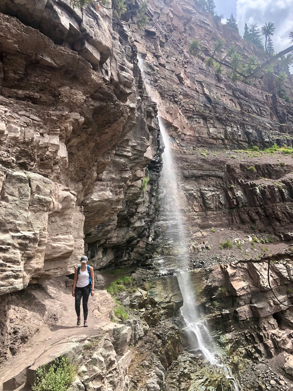
Parked at the town’s visitor center, the trail took us up to Cascade Creek Falls, which overlooks Ouray. The trail then continues around Ouray. There are signs for bears but we only saw a deer along the way.
After crossing the Million Dollar Highway which descends into town, we opted for one of the spur trail shortcuts into downtown for lunch at the Ouray Brewery (rooftop seating overlooking downtown at which point it started to rain a little bit), then a stroll through downtown back to the car. We ended up hiking just over 6 miles.


Afterwards, we drove up the Million Dollar Highway to the Red Mountain Pass overlook and read about the area’s mining history. The name “Million Dollar Highway” presumably came from the area’s old and rich mining history. But legend has it cost a million dollars a mile to build it back in the 1920s.
It’s a hazardous and a bit frightening drive on the tight twisty curves and long steep drop offs to the side without guardrails. There are seventy named avalanche paths that intersect this highway in the 23 miles between Ouray and Silverton. We then made the 1 hour+ drive to Telluride.


Telluride - is known for being more upscale...the Aspen of southern Colorado. Approx population is 2,000. The real estate and lodging here isn’t cheap. We couldn’t find reasonably priced AirBnBs but did find a reasonable Queen/Twin Kitchenette room at the Mountainside Inn which sits right along the San Miguel River and just a short walk from the gondola.
I looked at an area real estate magazine. A Victorian style 3 bedroom, 3.5 bath house on Pacific Avenue close to downtown was listed at over $4.5M. Upscaleness aside, Telluride is a beautiful town. A real adventure town too. Like Ouray, it is surrounded by big rocky mountain peaks and big waterfalls. There were a lot of young people, many runners, walkers, bikers, dogs, and custom 4WD sprinter vans and other off-road vehicles. There are great walking/running/biking trails along the river, which yes, does run through town.


To top it off, the ski area is right there. The gondola rides are free...yes free. You can ride the gondola up to the top of the mountain and ski (in winter) or mountain bike (in summer) down the other side of the mountain to Mountain Village town and resort (also with a free gondola), or back down to Telluride. If you’re lucky enough to live here, you could ski down the mountain, kick off your skis at the bottom and literally walk to your home or right into downtown for the apres delights.
The temperature here was also perfectly in the low 70s and it had just rained. McIntyre and I ended the evening at a nice Italian downtown restaurant, Rustico Ristorante. We had a big day ahead of us. McIntyre planned a big challenging hike for us. The Ice Lake Basin trail...rated as the best hike in southern Colorado. We were excited.
Friday July 17th
When you hike the high alpine mountains of Colorado in the summer, you have to begin super early because of the usual thunderstorms that set in around lunchtime. I learned this many years ago from my Colorado friend Neil on our backcountry adventure in the Indian Peaks Wilderness/Continental Divide and at Longs Peak. The forecast for our hike up to Ice Lake Basin was blue sky but then thunderstorm activity starting around 11am. So we needed to be well off the top of the mountain well before then.
We needed to be at the trailhead by 6am which meant we had to get up at 4am for the drive there. Google Maps showed 2 routes - 2 hour drive back through Ouray and along the Million Dollar Highway. Or save 15 minutes and take the 1 hr 45 min route through Ophir. Google Maps said “this route may include unpaved roads”. No big deal I thought, we drive forest service roads all the time. Plus, the community of Ophir is on this road so how bad can it be. Little did we know the high pucker factor white knuckle experience that was ahead of us.
The words “Ophir Pass” will live in infamy. To truly test a production car’s actual 4WD limits, this is about as crazy as it can get. When the road turned from pavement to gravel, it was pretty tame...the usual forest service gravel road. Then we entered the tiny town of Ophir, which was interesting. Although it was still dark, it reminded me of the tiny town of Edgemont in the Wilson’s Creek area of North Carolina. I’m fascinated that people live in these such remote areas. It’s wild and in the middle of nowhere. And no cell phone signal to be had.
We started up the mountain. There was a sign that said 4WD only. My daughter’s Ford Escape is automatic 4WD. It got bumpier. And steeper. We crossed over a small creek. OK, I thought this was getting interesting. It was still dark...about 5am. McIntyre got real quiet. There were big drainage culverts we had to navigate up and over. I was going super slow...less than 5mph, so I wouldn’t bottom out her car. Then the road narrowed and got even steeper. The gravel turned into large rocks that would slip and spit out from the tires and make loud noises as they hit the undercarriage. The wheels were slipping a little bit, but the car’s automatic 4WD was working overtime and doing its job as we made our way up the steep and loose rock road. I could sense a deep abyss off to the passenger side. McIntyre sensed it too and wasn’t happy.
We were literally on the precipice of a rocky mountain. The road was so narrow, there was no way for me to turn around. We were past the point of no return. There was no one else around. 1 mile seemed like an eternity. My hands were gripped so tightly around the steering wheel that I had to force myself to relax. My right leg was hurting from all the action on the pedal. There was no way I was going to let our car fall off the side of that mountain so I figured worse case, we would get stuck and have to wait for someone to come along to help us. I relaxed a little bit and kept focused on maintaining momentum. If I had stopped, we would possibly have gotten stuck.

These are a couple of screen grabs from a YouTube video of someone 4WD'ing Ophir Pass during daylight.

I tried to make light of the situation and said to McIntyre, “when it gets hard on our climb up the trail later, we’ll say at least we’re not on Ophir Pass”. After a couple of scary and tight ascending hairpin turns, we seemed to finally reach the top. We breathed a deep sigh of relief and thankfully it turned out the descent down the other side of Ophir Pass had a slightly lower pucker factor and wasn’t quite as technical as the ascent. But we still had a few more miles to get to paved road again.
After what seemed like an eternity, we got to smooth pavement for a short stretch before heading off onto another gravel forest service road. This time it was thankfully smoother. The Ford Escape barely passed the 4WD test. I wouldn’t drive Ophir Pass again unless I had a high clearance 4x4 specific truck. We reached the Ice Lake Basin trailhead which was next to a remote campground. And we were on time...6am as planned. It was first light. Many cars were already there and people had already gone up earlier or were also preparing for the big hike up.


The Ice Lake Basin Trail takes you up to a series of small glacial lakes. It is a serious hike up. Unrelenting climbing with many switchbacks and some steep rocky sections. We started at 9,600 ft elevation and hiked over 3,000 ft elevation gain in just 4 miles.
We stopped on the way up many times for lung and leg rest breaks. We could definitely feel the sudden altitude change as we both had headaches. At one point, I turned to McIntyre and said, you guessed it, “at least we’re not on Ophir Pass”.


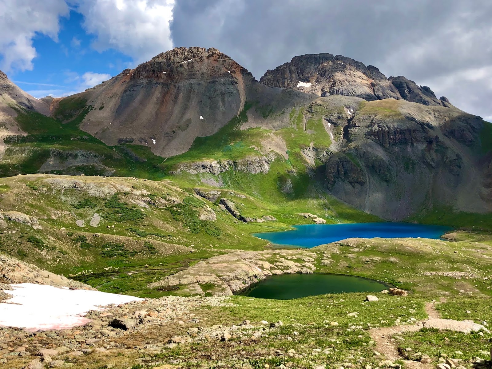
The hike can include a loop towards the top that features multiple glacial lakes. The AllTrails app recommended doing this loop counter clockwise as it had a more gradual climb. Wow, if this was gradual, I couldn’t imagine what it was like in the other direction which we would later descend to see a different beautiful view on the way down. The first lake we came to was Island Lake. Aptly named since it had a round rock dome of an island in the middle.
Then we continued on up to the main feature, Ice Lake. The water was so blue because it was deeper. It reminded me of the deep dark and light blue colors of Crater Lake in Oregon. We topped out at just over 12,600 ft elevation by doing another mile further up to see another glacial lake, Fuller Lake. The wildflowers were in full bloom throughout the hike.


I noticed clouds were starting to appear. We rested there for a short bit then hiked the mile back down to Ice Lake and enjoyed turkey sandwiches that we had packed for an early lunch by the lake. It was 10am. By 10:30am, the clouds were really setting in with a change in appearance, becoming more ominous. We started down the mountain at 10:40am.
That first section descending down the other side of the loop was even steeper and rockier. It was tough on our knees but we were glad we followed the counterclockwise recommendation...and glad to be going downhill.
Right on cue at 11:10am, we heard the first thunder. We picked up the pace. People were still hiking up. We couldn’t believe it. Surely they heard the thunder. More boomers sounded and they were getting louder. It started to rain. More people were going up including young families. I don’t mess around with lightning...at the beach or on a mountain. I take it very seriously and wouldn’t put my family in that kind of danger.
Clearly, other people either don’t have the knowledge of lightning danger on a mountain or are just willing to take the risk. Unbelievable either way. We reached the car at 12:15pm. Tired and happy...we reflected back on how epic that was.


Needless to say, we gladly accepted the extra 15 minutes of drive time and drove the longer way around over the Million Dollar Highway again back through Ouray and on to Telluride. We arrived around 2:30pm in time for a dip in the hot tub and some quiet nap time in the room. We were so hungry and walked to an early 5pm dinner at nearby Siam, a fantastic Thai restaurant. They were serving take out food and drinks and we could sit at their outside picnic tables. Drunken Noodles never tasted so good.
We then took a quick drive through the rest of Telluride taking in all the sights. They had one half of the usual two way street through downtown blocked off, making it a one way street to allow the restaurants to expand their outdoor seating areas. It was a genius move. Live music was being performed from a blocked off stage. Restaurants and bars were serving drinks with tops on the cups and you could walk around downtown with drink in hand or sit in blocked off designated communal safe distancing areas to eat and drink.
Everyone who wasn’t eating or drinking were wearing masks. Even though their usual summer festivals were cancelled, Telluride seemed to have figured out how to make lemonade out of lemons.

Then McIntyre and I parked the car back at the Inn and made the short walk on the river trail to the free gondola. We hopped on (masks required, and they quickly disinfected each gondola after someone got off) and enjoyed the ride up, taking in the views. We walked around the top overlooking both Telluride and Mountain Village, before heading back down.
Saturday July 18th
We got up early, had a nice breakfast in downtown Telluride, then made the 1hr 45min drive to Mesa Verde National Park. We had both wanted to visit this park to see the interesting history of the cliff dwellings populated by Pueblo Indians dating back to 900 AD. Based on friends’ suggestions, the best way to experience this park is to take guided ranger tours into the dwellings.
Unfortunately due to Covid-19, these guided tours and trails to the dwellings were closed. But you could still drive the park, and see the cliff dwellings from overlooks. We knew this going in but still wanted to see it. There were a few areas where you could walk around some old “houses” and other formations to see how the Pueblos used to live, so we took advantage of that.


We then made the 40min drive to Durango and had daylight left. What should we do? Well, I know about this river that runs through town and I recall seeing rafters and kayakers on it last weekend when I was mountain biking.
So we made a quick online reservation for a 2 hour rafting adventure. Then it went from sunny 80s to a cooler high 60s with some rain. Luckily the rain stopped and the temp climbed back up into the low 70s.


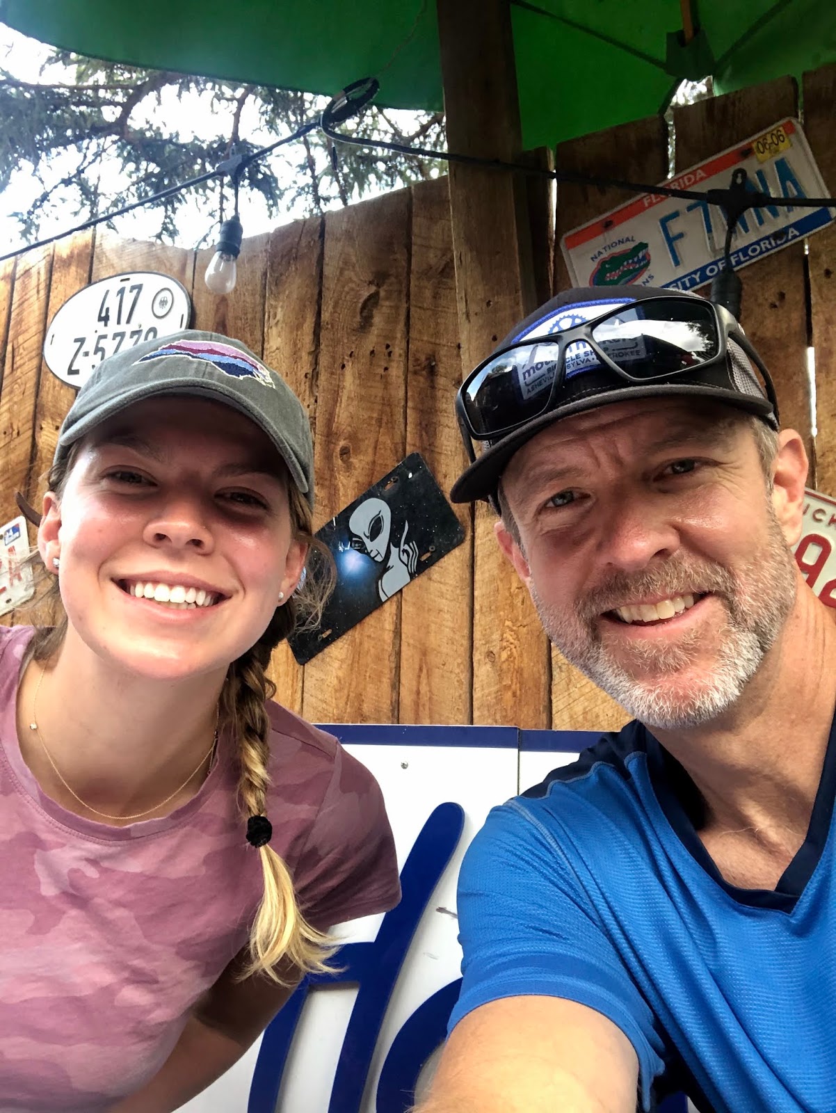
We chose to ride together in an inflatable double kayak, also called a “duckie”. Our guides Annie and Ben were excellent and we followed their paths around the rocky river formations and through Class 1 and 2 river rapids, ending with an exciting run through a Class 3 wave. So. Much. Fun. See the smiles on our faces?
We ended the evening at the trendy downtown 11th Street Station, which consists of a bar (masked server takes your drink order at your table) and multiple food trucks. A solo live music performer was in attendance. Except for the masks and safe distanced tables, things felt normal.
Sunday July 19th
McIntyre dropped me off at the Durango airport and she continued on her road trip adventure. Next stop for her was the Great Sands Dune National Park. Afterwards, another stop in Colorado Springs, then Kansas City again with her friend. I felt good knowing she had the knowledge, experience, and the attitude to make the rest of the way a fun and safe one.

Final Thoughts
The 8 days felt like 2 weeks - in a good way. There was barely a moment when we were sitting still. Our total hiking stats in those five days together was 32 miles and 5,731 ft elevation gain...and that doesn’t include all the walking around town that we did. Combine that with my earlier mountain biking and I biked/hiked 105 miles with almost 15,000 ft elevation gain.
I love a lot of places. I love all of North Carolina, Charleston, Hatteras Island, Hood River and Oregon. And I love Colorado. The red rock of eastern Utah was great to visit and experience...Arches & Canyonlands really stood out...but I’m not a big desert guy.
It was a gift to spend 1:1 time with McIntyre in a way that was different than usual. She had studied abroad in Sydney, Australia this past spring and I was supposed to meet her out there in May and we were going to spend 2 weeks together touring the South Island of New Zealand. Due to the obvious, those plans got cancelled. So this trip was our way of blowing off that disappointment and following another adventure. We felt so easy around each other. I think I only got her nerves a couple of times (haha...probably more). Not bad for an impatient, sometimes cranky father. We did this trip in a way that let her dictate the itinerary and I got to just go along for the ride. And what a ride it was.
National Park and other web sites we used for research
-----------------------------------------------------------------------------------------------------------
*Covid-19 Disclaimer: I can't believe I even have to write this but...I wrestled with doing this trip in the midst of the pandemic but I ultimately felt that I could balance the safety and health of myself and those around me, still travel safely, and support local businesses in some small way. We wore a mask at all times, except when we were alone, riding / paddling / hiking at safe distance, or eating/drinking.
Everyone in Colorado/Utah was doing the same and other precautions were being taken. For example, masks were required at all businesses...and at a restaurant, you couldn't go to the bar...you had to be seated at a safe distanced table to order a drink or food.
Flying was ok. It's not easy to wear a mask for an entire flight as its a bit claustrophobic, and they didn't serve food/drinks. But everyone wore their required masks and no one complained. When I arrived back in the Charlotte airport, it was packed....pre-pandemic traffic...and everyone in the terminal was wearing a mask.
