In early May, my friend Rob and I embarked on a backcountry biking/camping trip for 3 days in Canyonlands National Park, Utah, on the (in)famous White Rim Trail. We enlisted with Rim Tours, who provided guides and a support truck to follow us with food, water, our stuff, and other needed supplies.
We arrived at the Rim Tours office in Moab early on the first day ready to go and were met by our guides, Scott and Reid, who gave us a briefing on our Day 1 adventure. We also met the others in our group, who would become fast friends…great people from Salt Lake City, Central California, and NYC/New Jersey. There were 13 of us, plus the 2 guides. The National Park Service caps the number of people at each White Rim Trail campsite at 15 people. Rim Tours had our campsite permits and we were ready to go.
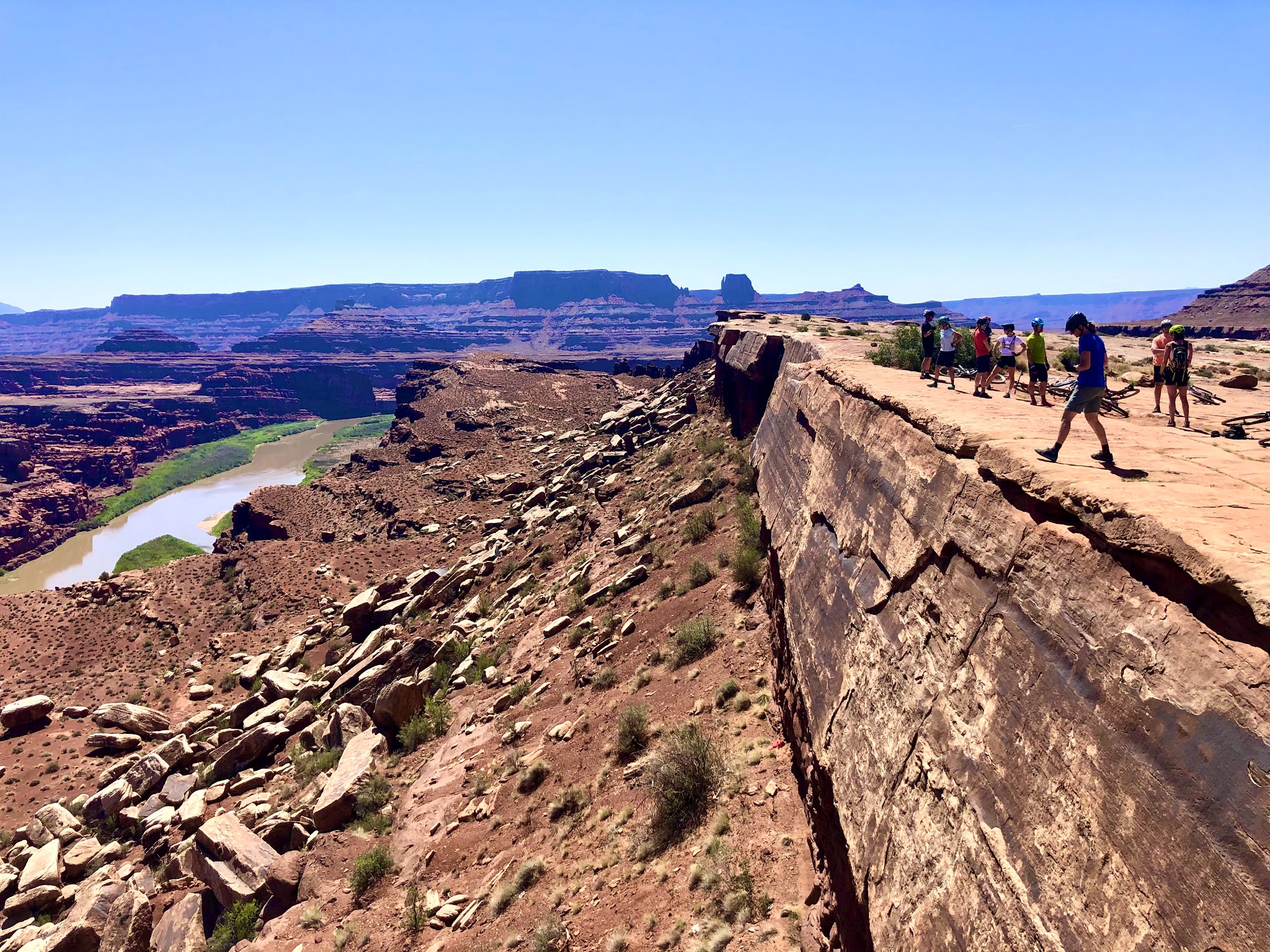
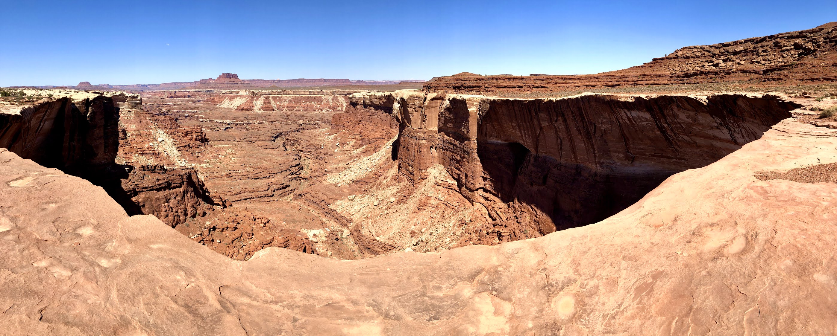
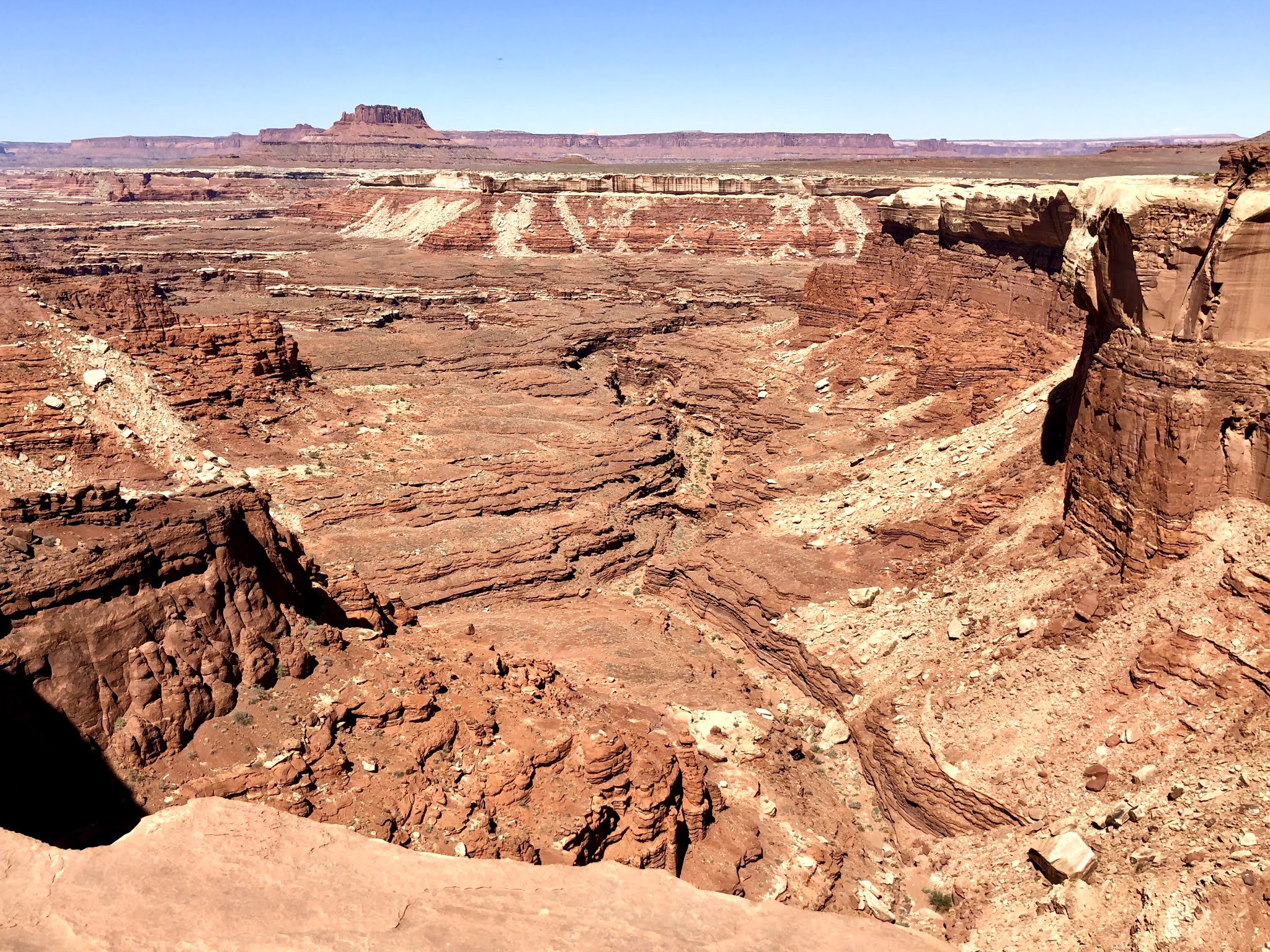
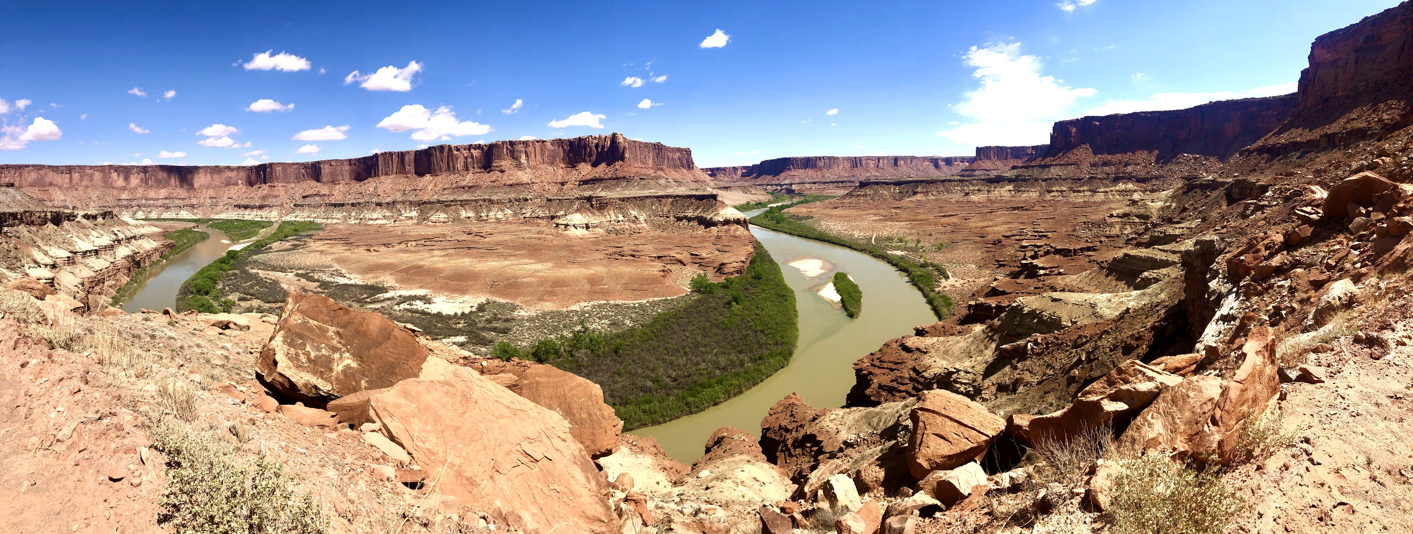
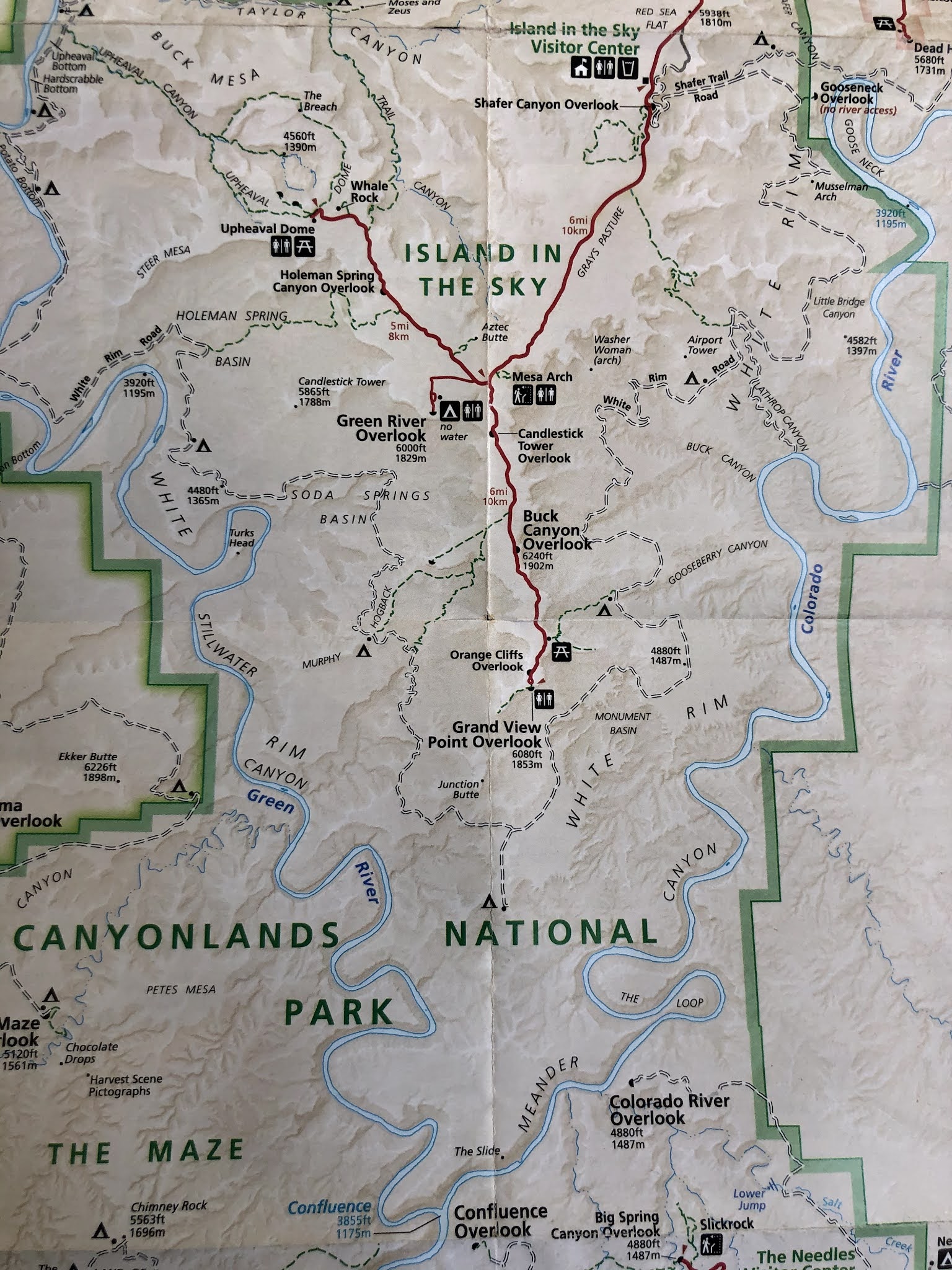
The White Rim Trail is located in the Island in the Sky district of Canyonlands National Park. Island In the Sky is a broad mesa wedged between the Green River and Colorado River, just above where they meet. At the top of this mesa are views of canyon after canyon as they stretch to the horizon 100 miles out. Closest to the mesa’s edge is the White Rim, which is a nearly continuous sandstone “bench” 1,200 ft below the Island. This is where we biked and camped, along the “White Rim”. Another 1,000 ft below the White Rim are the rivers. And in the background to all this is the snow-capped La Sal Mountain range.
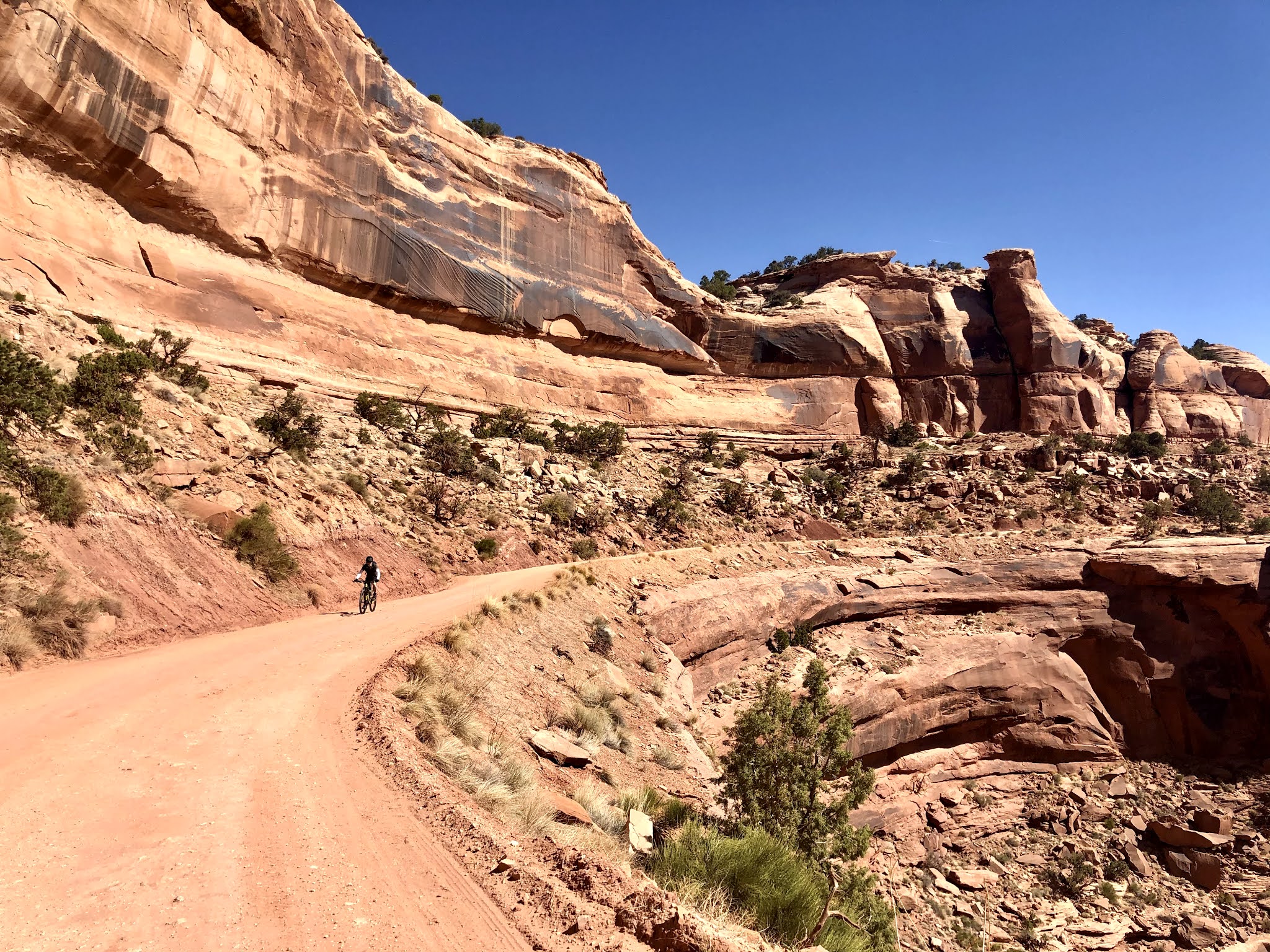
The full loop of the White Rim Trail is 100 miles. The Rim Tours route is 81 miles, leaving off the relatively boring and un-scenic portion that is a combination of flat gravel and paved road. The 81 miles we did was the scenic portion bordering around the white rim canyons, hence the name of the trail. It was a postcard around every corner. The canyons, rocks, features, etc were all so monumental, and so giant. Many of the photos below show the massive scale of it all especially with bikers in the foreground or background of some of these pics. Nature's artwork was truly at play and so impressive.
People do this trail in one day all the time. It’s a feat, especially if you do it unsupported because you need a lot of water for this ride and you’re exposed to the elements the entire way…the sun, the wind, the dust, the sand, etc. People have died out there. A couple of the Salt Lake City folks in our group had completed the one day lap around the White Rim Trail multiple times. This was their first time doing it in 3 days and they brought their wives, who were very talented bikers as well. They said doing it in 3 days gave them the opportunity to see and enjoy all the things they had not been able to see before.
The White Rim Trail is basically a 4x4 road. 4x4 vehicles are allowed on it and have to move real slow due to the technical 4x4 features throughout. It’s no joke and the 4x4 vehicles have to go slow. Doing it on a mountain bike is actually faster. The trail is made up of different terrain throughout - fine gravel road, solid sandstone rock, broken up rock, red dirt, sand, some technical sections, and there are fun downhill sections, and tough uphill climbs. In either direction, you have to drop into the canyon and then climb back out.
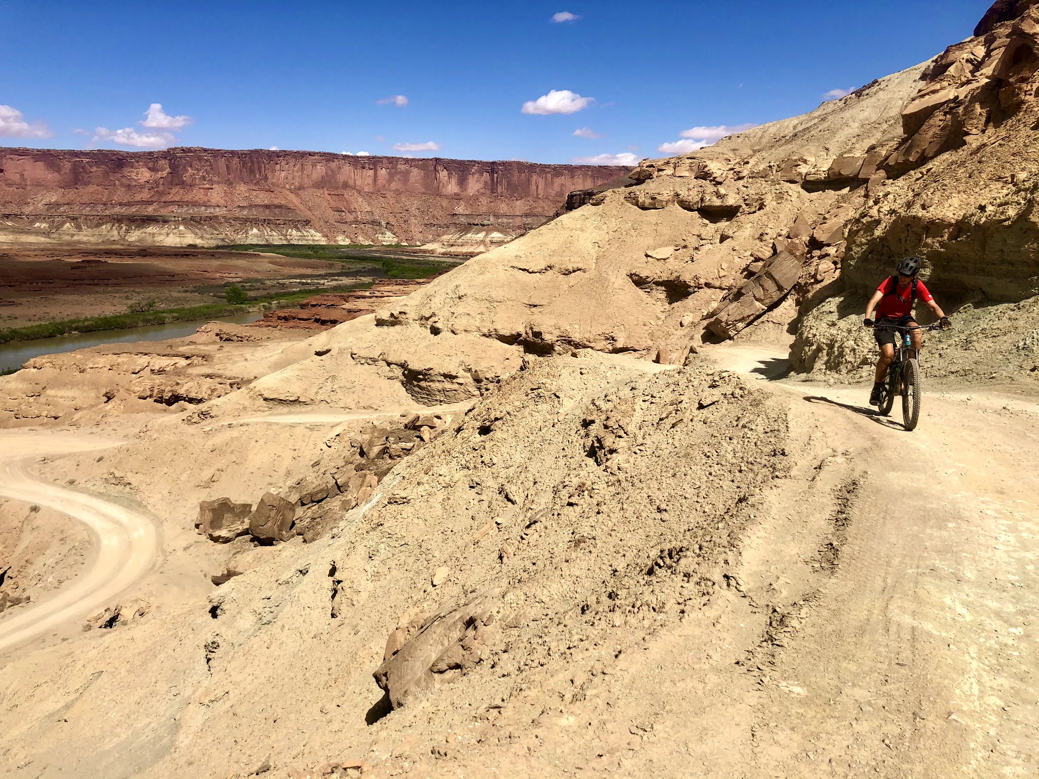
Our NPS approved route for our group was going clockwise, so we started down the Shafer Trail Rd portion of the trail, a series of switchbacks that dropped us approx. 1,200 ft elevation in about 4 miles. Then it was a series of ups and downs. Day 2 provided more climbing throughout (and fun downhills). The first 2 days views were very expansive with massive canyons and rock features throughout. Day 3 was different in that we were more closed in between canyon walls as we approached the “potato bottom” portion of the route, a large portion was along the scenic Green River, then we had a steep but gradual 2 mile climb with over 800 ft in elevation gain to the end.
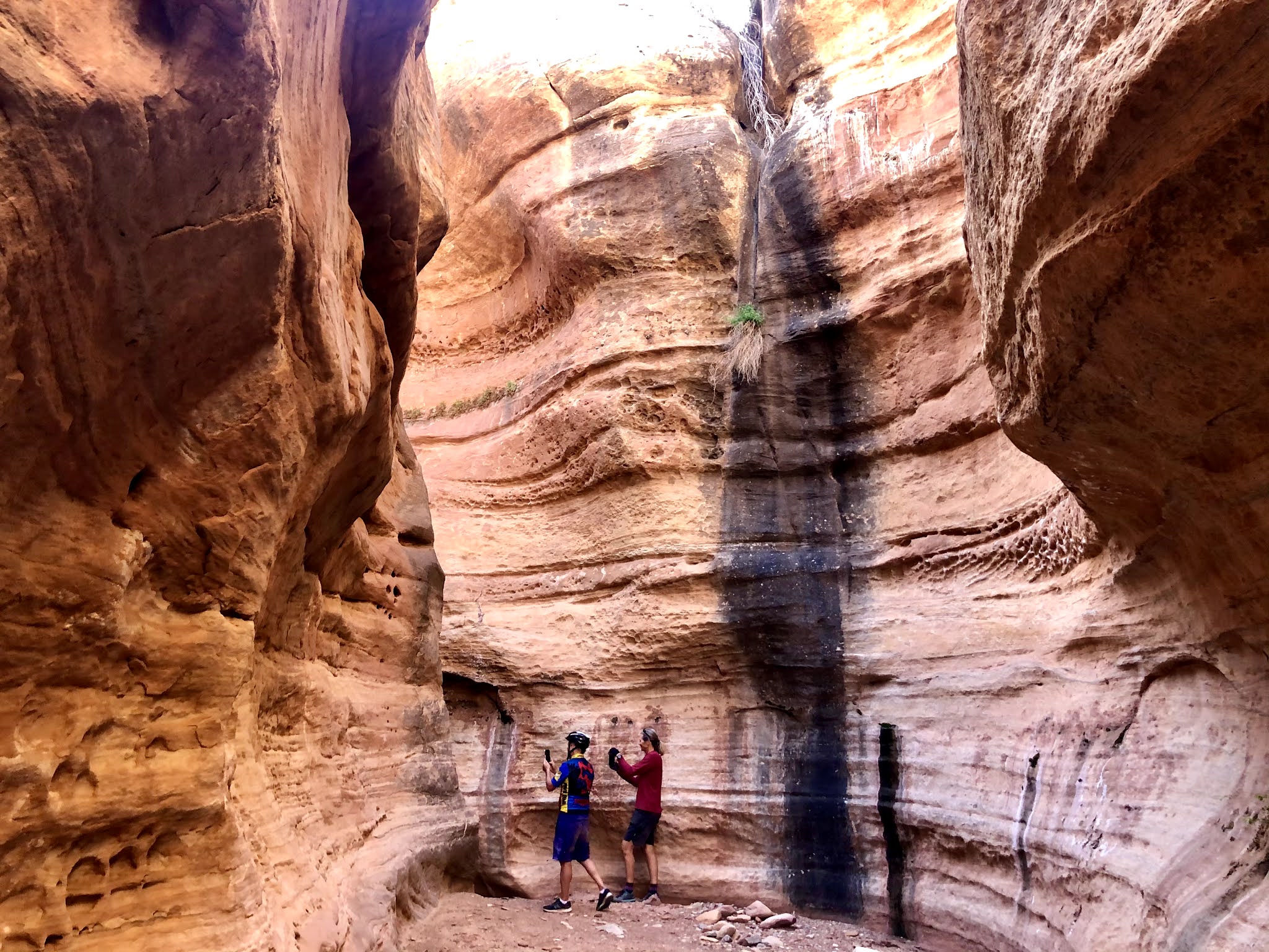
Scott and Reid were our excellent guides and couldn’t have been more accommodating, helpful, supportive, and always with a touch of fun humor. One of them would ride with us, while the other drove the support truck. They would switch places halfway through each day. We would stop at all the really interesting features and overlooks, including a really cool natural rock bridge/arch (Musselman Arch) on the first day and a slot canyon that we hiked on the last day.
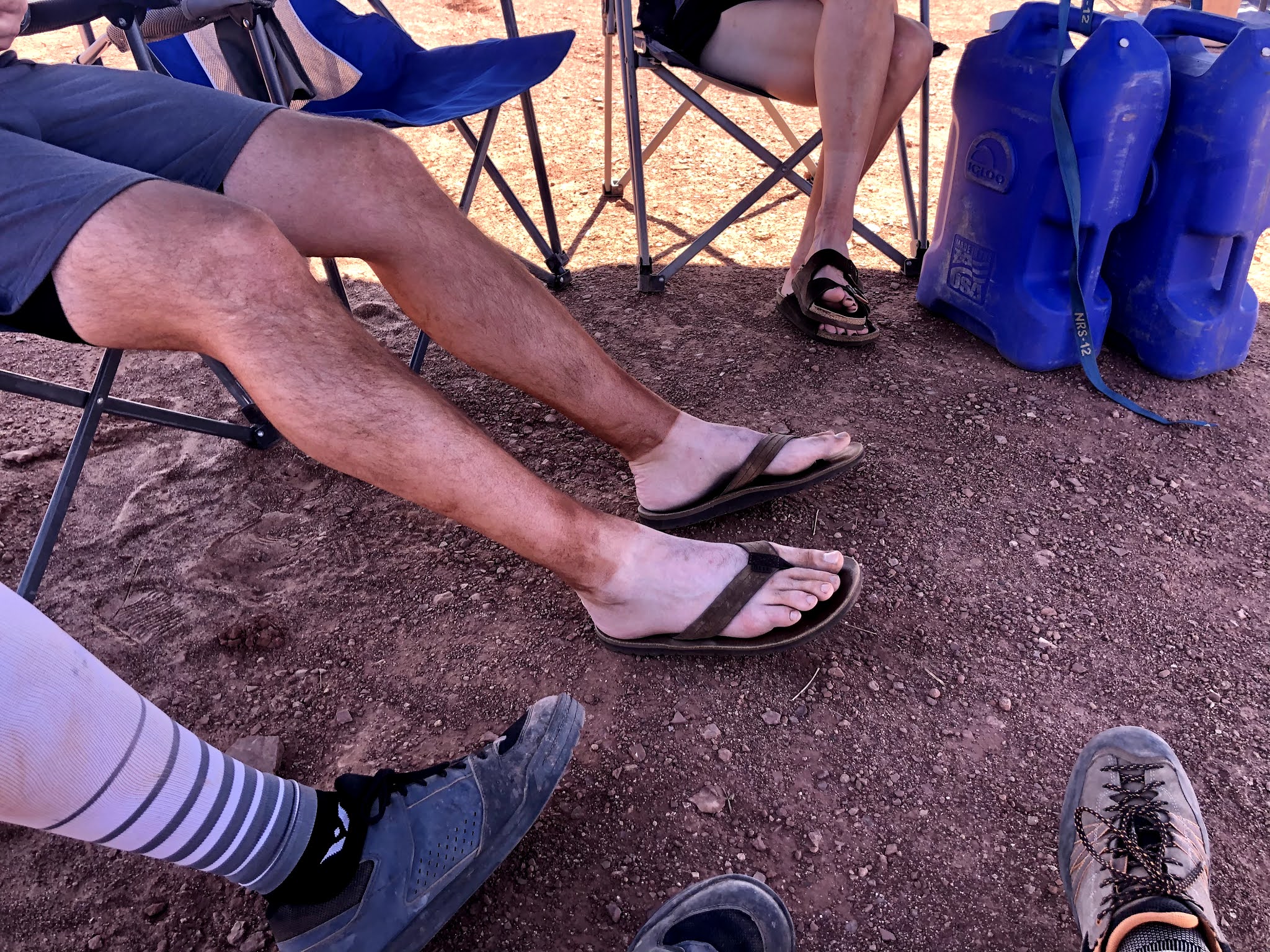
We would stop for lunch…break out the camp chairs and relax while Scott and Reid would whip up a delicious meal for us. Same for the dinners at the campsites. The meals were excellent. The only thing we carried while riding was our camelback packs or water bottles full of water, along with sunscreen, snacks, anything else we might need while riding on the trail. The support truck carried water and snacks (energy bars and fruit) for us to replenish at all the stops, and carried our camping gear, food, our bags, etc. They also supply non-alcoholic drinks for everyone. You can bring your own beer and throw it into their cooler, which we did. There was a pit toilet at each campsite, and a foot pump/bladder camping shower was provided from the truck on Day 2 to rinse off. Otherwise, we used wet wipes to clean off at the end of the day.
You can rent camping gear from them or bring your own, same for the bikes. I opted to rent my bike (a sweet Santa Cruz Tallboy), but brought my own tent, sleeping bag, and sleeping pad. The rental camping gear they had was nice stuff. The Salt Lake City folks brought their own bikes. It all worked out really well for everyone. We lucked out on great weather….no rain and wasn’t too cold at night. It was a little chilly in the early morning (low to mid 50s) - I got away with wearing shorts and 2 layers up top plus a down vest.
The nights were incredible. That area of Canyonlands is considered a “dark sky” area, so the stars were amazing. I had just gotten in my tent the first night when I heard some of the Salt Lake City crew shout that they were seeing some crazy lights. 30 to 40 solid lights all in a row moving across the sky above us – it turns out it was Elon Musk’s Starlink satellites that had been launched just a week before. We also saw many other individual satellites moving across the sky both nights, as well as shooting stars.
I didn't think about it much at the time, but looking back - not having a cell phone signal for close to 3 days was so nice. Even though we were out in the elements and getting dirty, I was very relaxed and invigorated at the same time. I think it was a combination of where we were, the scenery, the biking, the camaraderie with like minded people, and not looking at the phone for almost 3 days straight. I did manage to get one quick text off to my wife the morning of Day 2 to let her know we were good, but that was it. And that was only after someone else mentioned they had a signal on their phone....otherwise I wouldn't have even checked. I didn't have a signal the rest of the time on the White Rim Trail. It was so therapeutic.
The only wildlife we saw were some bighorn sheep on our first day. Apparently this area doesn’t have too much in the way of snakes or scorpions like some other desert/canyon environments. There are coyotes and the rare mountain lion but we didn't see any. Scott mentioned there are small pygmy (or midget?) rattlesnakes out there but they are very timid and are rarely seen.
You are exposed to the sun all day. There were very few shady spots to rest…we found only a few…under a rock overhang or a small tree. Vegetation is very sparse here. I wore a lightweight long sleeve shirt each day to cover my arms from the sun and was comfortable in that, and used sunscreen on my neck, face, and legs. We drank water constantly, easily a gallon a day, along with electrolyte tablets or powder. We ate a lot throughout the day too. As a result, I felt great each day.
Day 1 stats: 29.3 miles, 1,778 ft elevation gain, high of 85-90 degrees, light wind, low in low to mid 50s
Day 2 stats: 26.5 miles, 2,110 ft elevation gain, high of 85 degrees, 20-30 mph wind, low in mid 50s.
Day 3 stats: 25.3 miles, 1,972 ft elevation gain, high of 75 degrees, combination of overcast and sunny skies, 10-20 mph wind, low in mid 50s.
If you’re in good biking shape and feel you can cover those distances in 3 consecutive days exposed to the sun and elements all day (we did stop a lot), I highly recommend this trip. Rim Tours does these trips in the spring and fall, and also offers it in 4 days, covering less miles each day and camping an extra night. They also offer guided tours/rides in other areas of Moab, Utah, Colorado, and even the North Rim of the Grand Canyon.
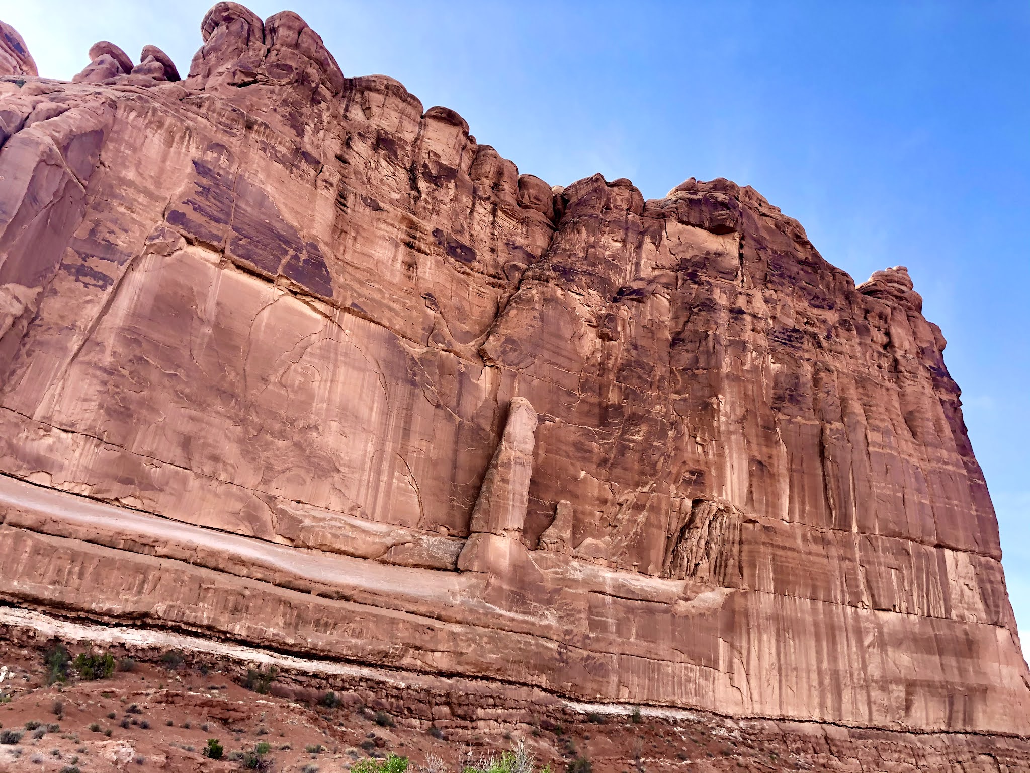
We got back into Moab at the end of Day 3 and celebrated with real showers, some brews at the hotel pool, then walked to dinner at the excellent 98 Center restaurant for some Vietnamese fare. Rob and I had an extra day after this adventure. Since we had tired legs, we opted to do some hiking instead of more mountain biking in the Moab area. Rob had not seen Arches National Park before, so we arrived there just before sunrise and made the drive throughout the park and stopped at a bunch of the pull outs and did some short hikes where you can see some of the Arches.
Then we had a big breakfast back in Moab, then set out driving along the scenic Highway 128 north along the Colorado River and its canyon walls to hike at Fisher Towers. This was a beautiful 4.5 mile out and back hike (suggested to us earlier by our guides Scott and Reid), with over 1,000 ft elevation gain. It had different features than what we saw along the White Rim Trail and in Arches NP. It had very tall rock “towers”, as big as city skyscrapers. It was a good way to keep our tired legs moving for recovery but wasn’t too much. I highly recommend this hike since it also involves a very scenic drive to get there. Then we drove back to Salt Lake City late that day for our 6am flight home the next morning.
Moab is one of those classic adventure towns. It was full of adventure rigs…sprinter vans, RVs, and 4x4 trucks, all brimming with bikes, camping gear, and rafts/kayaks. I definitely plan to return to see more of Canyonlands, Arches, the surrounding mountain bike and hiking trails, and have some fun on the Colorado and Green Rivers.
Below is the pictorial with some more commentary. As usual, photos don't really do it justice, but it's close. Enjoy! (and click on them to scroll through for larger format viewing)
 |
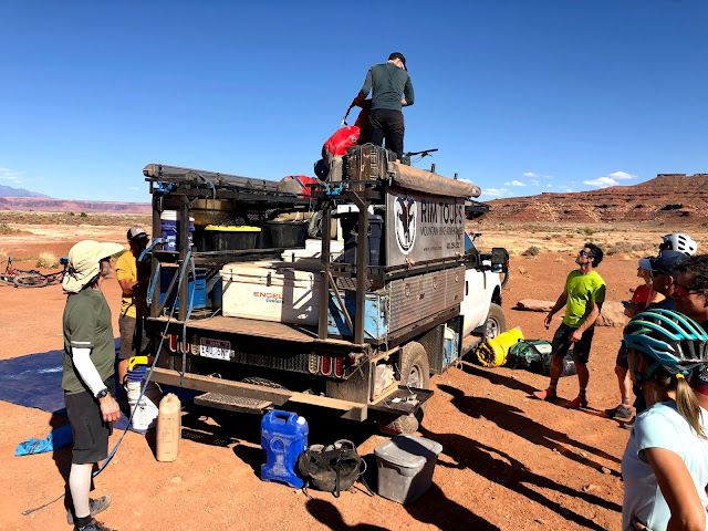
| Loading up in Moab |
 |
| The view from the top of Shafer Trail before riding down the switchbacks. That 4x4 road/trail way down there was where we were headed. |
 |
| Shafer switchbacks |
 |
| This pic gives a good sense of the steep drop offs & edges. |
 |
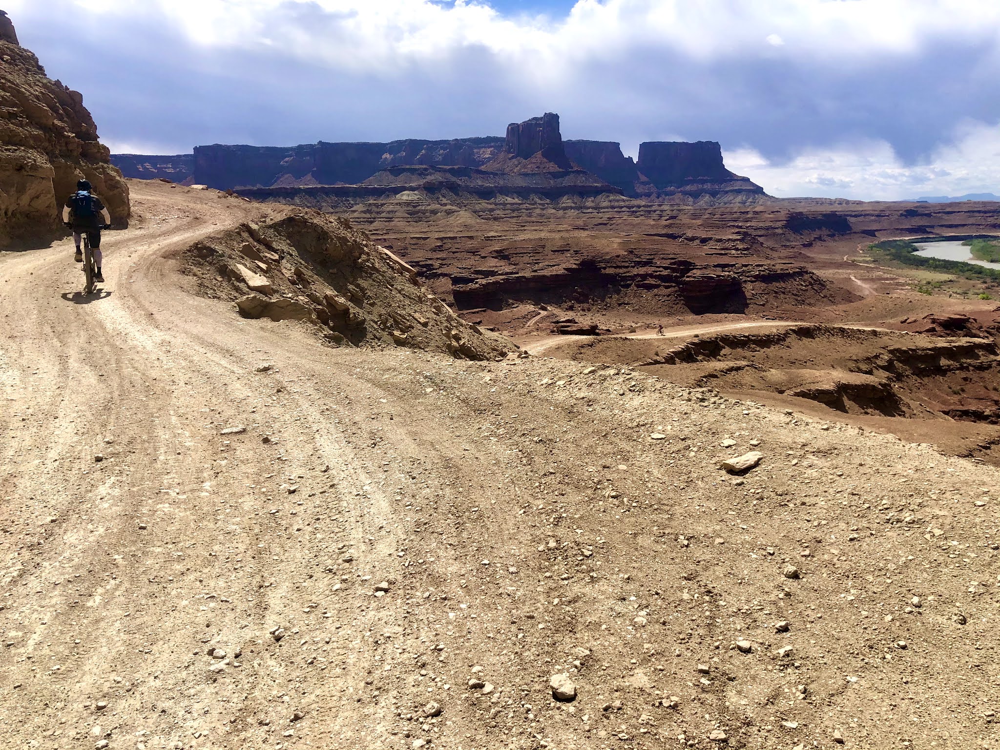
| For scale - can you make out the tiny bikers on the trail - on this pic and the one below. |
 |
| the La Sal Mountain Range in the distance |
 |
| Shafer switchbacks - if we had ridden the trail counter-clockwise, we would have had to ride up this. The climb out on the other end was similar. |
 |
| Big Horn Sheep |
 |
| one of the many edges and look outs we stopped to oogle over - that is the Colorado River. Note the giant rocks broken off the rim over time. |
 |
| Spot the big horn sheep? Look bottom left. |
 |
| Big Horn Sheep |
 |
| Musselman Arch (actually it's a natural bridge). You could drive a car over it (not recommended!) |
 |
| Colorado River |
 |
| Note the "white rim" - this section is where part of the "rim" broke off. Those broken off rocks are as big as houses. |
 |
| a 4x4 vehicle in the distance slowly making its way. |
 |
| a stop for lunch with our support truck. |
 |
| our group resting |
 |
| A rare shady spot. The first day was the hottest. |
 |
| White Rim contour |
 |
| our support truck in the distance |
 |
| our new friends Nettie & Liz with the La Sals in the background. |
 |
| our group helping to offload everyones' bags |
 |
| another rare shady spot - note the balanced rock - how does that end up like that? |
 |
| the long and winding road |
 |
| Sunrise - first light hitting the rock |
 |
| Rob & I |
 |
| Note the "white rim" |
 |
| getting ready for breakfast |
 |
| the White Rim |
 |
| Our group launching for Day 2 |
 |
| it was a long way down |
 |
| Massive! |
 |
| Massive - note our group in the distance |
 |
| what a great group of folks we met on this trip |
 |
| Note the bikers in the middle |
 |
| Day 2 climbs |
 |
| some good climbing on Day 2 (and downhills on the other side) |
 |
| Nettie - turns out she is an outrigger paddler and was on the same World Championship Dragon Boat team as our Charleston friend Jess in Thailand a few years back. |
 |
| "White Crack" - it was very long and you couldn't see the bottom. |
 |
| the Green River behind us |
 |
| Our reliable and sturdy support truck |
 |
| a bit dusty out there |
 |
| Day 2 campsite |
 |
| sunset light hitting the rock behind our camp |
 |
| Desert nights |
 |
| The Green River |
 |
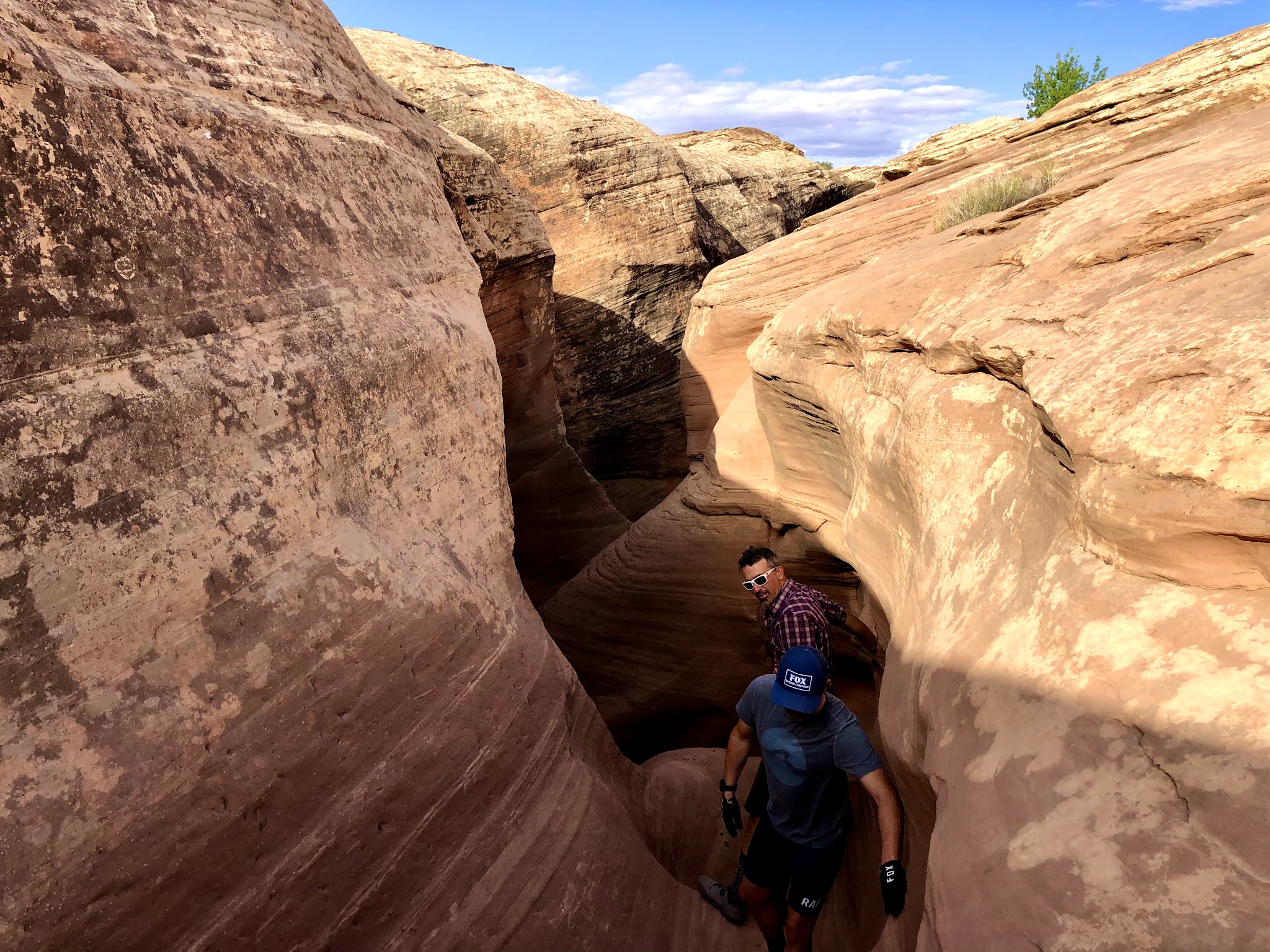
| the beginning of our slot canyon hike |
 |
| we had to wedge ourselves up and down some of the slot canyon using all four limbs |
 |
| Rob and I |
 |
| Climbing out of the slot canyon |
 |
| That square under the rock overhang is a "granary". Its thought to have been built hundreds of years ago and was used to fill with grain and other supplies for weary travelers who came through here on horses or by foot. It's bigger than it looks, the size of a large bedroom. |
 |
| some of the Salt Lake City crew |
 |
| Riding along the Green River on Day 3 |
 |
| Look closer - that is petrified wood in the layers of that rock - more evidence of the seas rising and falling here over millions of years. |
 |
| Down there is our next lunch spot - middle right |
 |
| Nettie & Liz |
 |
| some of us took a refreshing dip in the Green River before lunch |
 |
| Reid broke out some cool old artifacts found along the trail - pieces of ancient pottery. |
 |
| a sign near the end of the trail (near beginning of trail if going counter-clockwise). It would take you 10+ hrs by 4x4 vehicle to drive the entire loop. |
 |
| The final climb out of the canyon - 800+ ft elevation gain in 2 miles - it was steep but gradual |
 |
| Looking up - those are switchbacks way up there |
 |
| Can you see the bikers and vehicles? |
 |
| Reaching the top |
 |
| Our route, started top right and biked clockwise, down, staying in between the Colorado and Green Rivers, and back up to the top left - 81 miles total |
 |
| Vietnamese dinner at 98 Center in downtown Moab |
 |
| morning of our 4th day - just before sunrise in Arches National Park |
 |
| Skyline Arch |
 |
| the view of Delicate Arch from the backside - below at a lookout |
 |
| Balanced Rock at sunrise |
 |
| massive - this pic doesn't do it justice |
 |
| Courthouse Towers |
 |
| Landscape Arch - the longest arch in the park |
 |
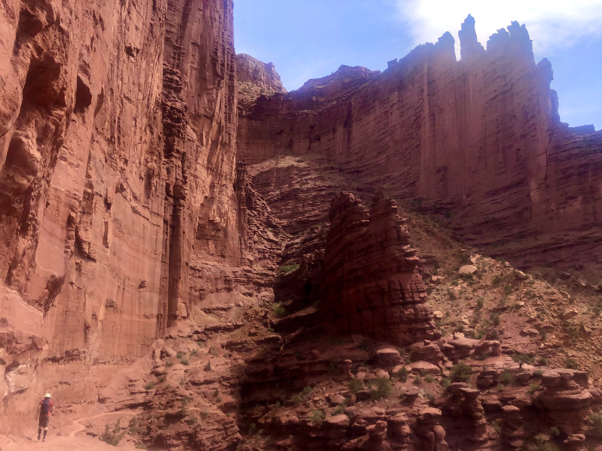
| Fisher Towers hike - note Rob at bottom left |
 |
| as big as city skyscrapers |
 |
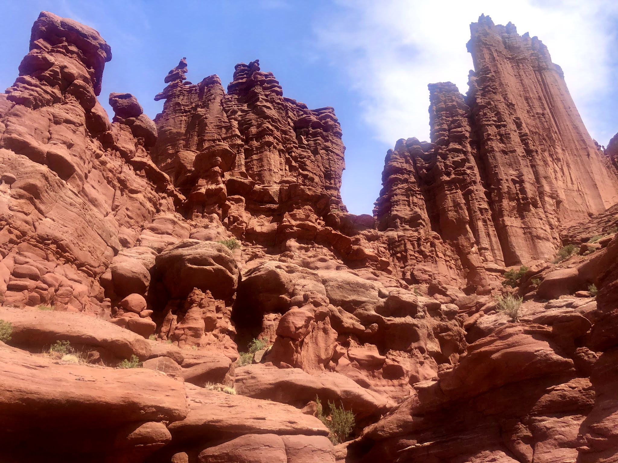
| Fisher Towers |
 |
| note the hiker at bottom |
 |
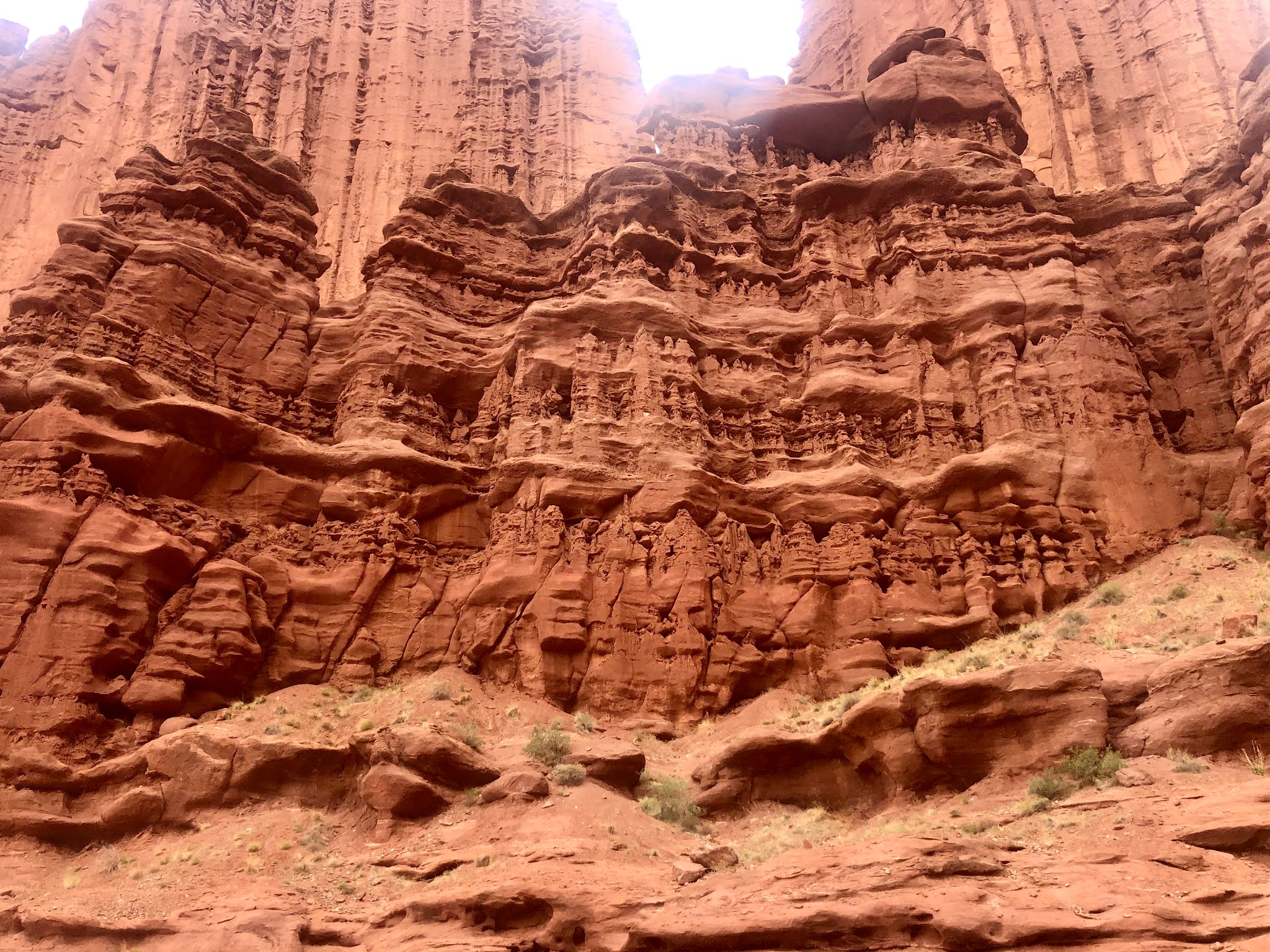
| Fisher Towers |
 |
| note the hikers at bottom |
 |
| Duckie kayaks on the Colorado River along Hwy 128 near Moab |